What RiskWise does
One methodology. Three kinds of result.
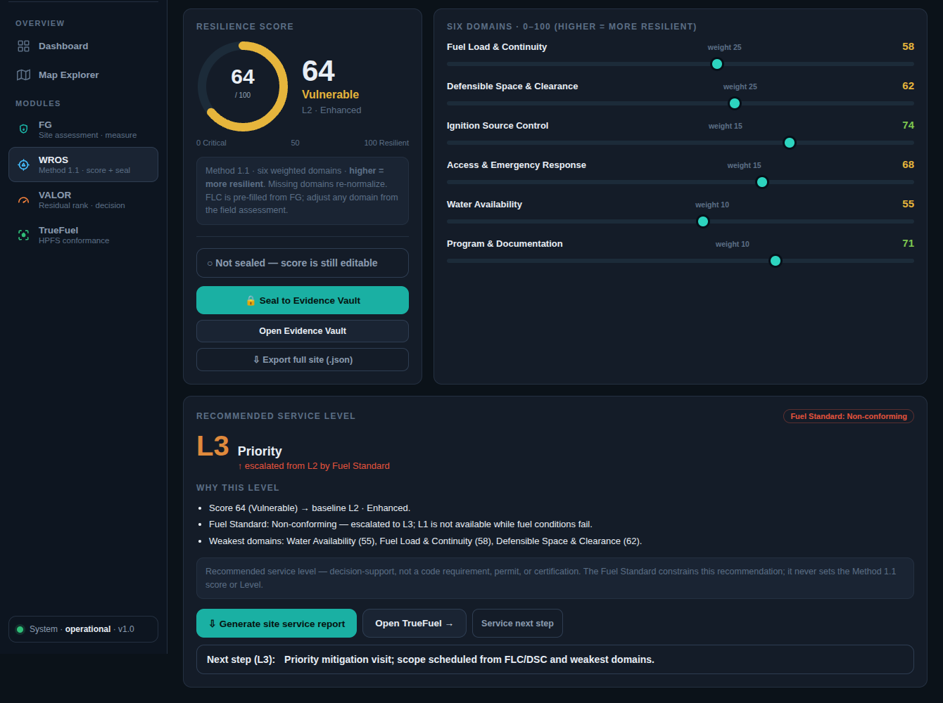
Scoring
Condition score
A 0 to 100 resilience score with a confidence range. Sparse or estimate-heavy inputs widen the range on purpose, so the score never claims more than was measured.
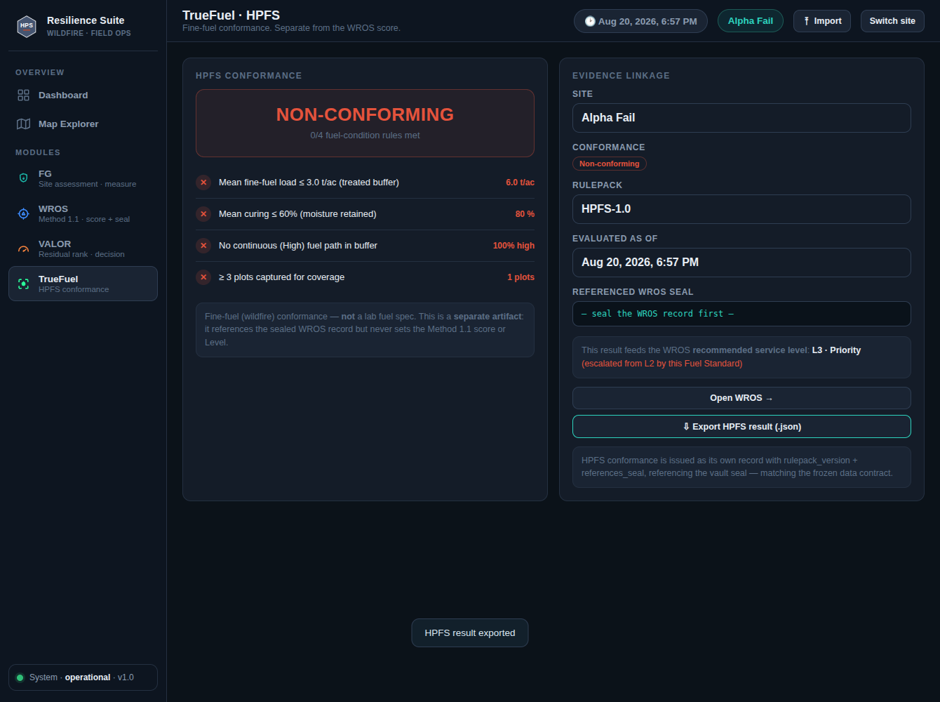
Conformance
Conformance check
Each measured plot is marked conforming, nonconforming, or provisional against the treatment plan. The check never changes the score.

Exposure
Exposure ranking
Ranks remaining risk across an owner's sites to guide where work goes next. It is decision support, not certification, and it does not set insurance rates.
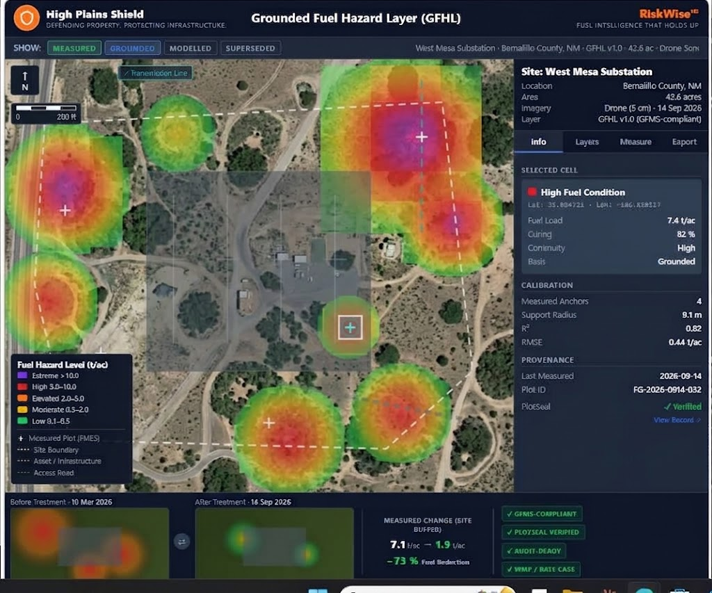
Mapping
Measured condition map
Plot-level measured conditions shown on a map for operations and reporting, kept separate from modeled estimates.